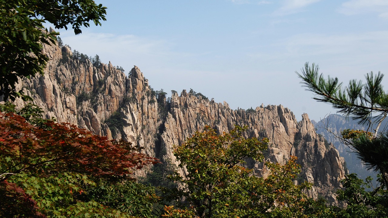
Korea’s mountains are among the most rewarding hiking destinations in Asia, and knowing when to go makes the difference between a transcendent experience and a miserable slog through heat or ice. The country’s four distinct seasons each transform the trails differently, and Korean hikers plan their calendars around these changes with near-religious devotion. Here is what every traveler needs to know before lacing up their boots.
Spring (March to May): Cherry Blossoms and Azaleas on the Ridgelines
Spring is the most popular hiking season in Korea, overlapping with the country’s famous cherry blossom travel season, and for good reason. Temperatures hover between 10°C and 20°C, making long ascents comfortable without the brutal humidity that arrives in summer. The real draw is the visual spectacle: cherry blossoms typically peak in late March to early April in the south, moving northward through April, while royal azaleas (참꽃, chamkkot) blanket high ridges from late April into May.
Hwangmaesan (황매산, 1,108m) in South Gyeongsang Province is the single best destination for azalea hiking. Every April and early May, the upper slopes turn entirely pink and purple. The Korea Tourism Organization and local festivals draw crowds of 50,000 or more on peak weekends. Arrive before 8 a.m. to get parking near the cable car base station; parking costs around 5,000 KRW. The cable car runs roughly 9,000 KRW one-way, but the walking trail from the lower lot to the summit ridge takes about 1.5 hours and is well-marked.
Jirisan (지리산), the largest national park on the Korean peninsula, offers multi-day spring ridge walks along the Baekdudaegan trail. The Nogodan–Cheonwangbong traverse (about 25km one way) requires advance booking at mountain shelters (산장); beds cost 11,000 KRW per person per night through the Korea National Park Service reservation system (reservation.knps.or.kr). Book at least three weeks ahead for April weekends.
Autumn (Late September to November): The Peak Season
If spring is popular, autumn is legendary. This is peak autumn foliage season — called danpung (단풍) in Korean — bringing crimson maples, golden ginkgos, and deep burgundy oaks to every ridge and valley from late September through November. Temperatures are ideal: crisp mornings around 5°C to 10°C and comfortable afternoons up to 18°C.
Seoraksan National Park (설악산) in Gangwon Province is ground zero for autumn hiking. The Ulsanbawi Rock circuit (6.2km round trip, about 3–4 hours) and the Biseondae trail are among the most photographed routes in the country. Entry to the park costs 3,500 KRW for adults. The Seorak cable car to Gwongeumseong Fortress ruins costs 14,000 KRW round trip — lines exceed two hours on peak October weekends, so purchase tickets online in advance through the Seorak cable car official site.
Naejangsan (내장산) in North Jeolla Province is smaller but arguably more intense for foliage color. The maple tunnel at the park entrance is iconic; the full Naejangsan crater loop is about 7km and takes 3–4 hours. Entry is 3,000 KRW. Shuttle buses run from Jeongeup Station (정읍역, KTX accessible) to the park entrance for 1,700 KRW.
Summer (June to August): Manageable with Strategy
Summer hiking in Korea is not for everyone. July and August bring jangma (장마), the monsoon season, with heavy rainfall and humidity that turns trails slippery and views nonexistent. However, early June and late August offer windows of clear weather, and higher elevations stay cooler than coastal cities.
Hallasan (한라산, 1,950m) on Jeju Island is a viable summer target because sea breezes moderate the heat. The Seongpanak trail (9.6km one way to the summit) is the only route to the crater lake, Baengnokdam, and requires starting by 6 a.m. in summer to meet the 12 p.m. mid-trail cutoff enforced by rangers. Trail entry is free. Take Bus 181 from Jeju City Bus Terminal to the Seongpanak trailhead for 1,200 KRW.
During the monsoon period, Bukhansan National Park (북한산) near Seoul is best avoided on rainy days — flash flooding and rockfall are genuine risks on the granite slopes. Check the Korea Meteorological Administration (weather.go.kr) the morning of any hike.
Winter (December to February): Ice Axes and Empty Trails
Winter hiking in Korea rewards the prepared, and the same cold snap that buries the trails also opens up the ski season at nearby resorts. Major summits like Seoraksan’s Daecheongbong (1,708m) and Jirisan’s Cheonwangbong (1,915m) accumulate significant snow and ice from December through February. Korean hikers treat this as a serious mountaineering season: a이젠 (crampons) are mandatory on most high-altitude trails and rangers at Seoraksan and Hallasan will turn back hikers without them.
A basic 6-point crampon set (아이젠) can be rented at gear shops near most major trailheads for 3,000–5,000 KRW per day, or purchased at outdoor shops in Seoul’s Dongdaemun Outdoor Gear Street (동대문 등산로) for 15,000–40,000 KRW. Poles with snow baskets are equally important.
The payoff is solitude and drama. Bukhansan’s Baegundae summit (836m) dusted in snow with Seoul spread below in winter light is one of the great urban hiking moments in Asia. The Ui-Dong entrance is reachable by subway (Bukhansan Ui Station, Line 4 extension) for standard fare around 1,500 KRW.
Choosing a Trail by Fitness Level and Time Available
Korea’s hiking culture assumes a level of fitness that surprises many first-time visitors — Korean day hikers in their sixties and seventies routinely tackle routes that would be considered strenuous back home. If you are travelling with a mixed group or only have a half-day free, matching the trail to your actual fitness, not your aspirational fitness, will make or break the outing.
For a gentle introduction, Namsan (남산) in central Seoul is the obvious choice: a paved loop around the base with the option to ride the cable car (as of 2026, around 11,000 KRW round trip — verify before visiting) up to N Seoul Tower rather than walking the final ascent. It suits families, jet-lagged arrivals, or anyone easing into the trip. Bukhansan’s Dobongsan area sits at the opposite end of the spectrum — steep granite scrambles with fixed ropes near the summit that demand real scrambling experience and are best avoided in wet or icy conditions.
A useful rule of thumb used by local hiking clubs: if a route is marked “difficult” (난이도 상) on trail signage or the Korea National Park Service app, budget roughly 1.5 times the posted time estimate if you are not hiking regularly, since Korean trail-time signage is generally calculated for a brisk, experienced local pace rather than a leisurely tourist one. This catches out more visitors than the weather does — parties who start Seoraksan’s Ulsanbawi circuit at 2 p.m. expecting a two-hour stroll are a common sight for rescue teams near dusk.
Who this suits: choose Namsan or the lower perimeter loop trails at Bukhansan (둘레길) if you have three hours or less, are hiking with children, or simply want skyline views without technical terrain. Choose Jirisan’s multi-day ridge or Seoraksan’s Daecheongbong summit push if you have a full day, proper boots, and previous experience hiking at altitude. A local tip rarely mentioned in guidebooks: many trailhead convenience stores (편의점) near major parks sell cheap disposable rain ponchos and hand warmers (핫팩) for under 2,000 KRW each — prices can vary by location and season — which is often more practical than hauling bulky wet-weather gear across an entire trip just for one hike.